
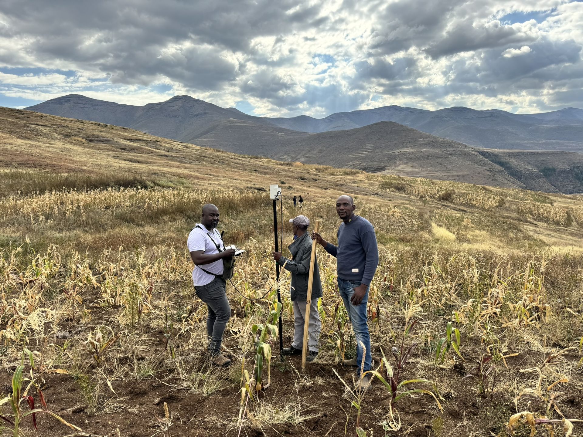
KwaZulu-Natal · Mpofana Local Municipality
Geophysical surveys in Mooi River
Geophysical surveys for sites in and around Mooi River, run by our team from Midrand.
Working in Mooi River
Geophysics for sites in and around Mooi River
Crysbol Consulting offers professional geotechnical, geological, geophysical and drilling services in Mooi River and surrounding areas. Our experienced teams provide efficient site investigations, technical expertise and reliable project delivery tailored to local project requirements.
Mooi River is the seat of the Mpofana municipality, on the N3 between Pietermaritzburg and Estcourt. It took its present name when it was declared a town in 1921, and a large textile mill was its main employer for decades until it closed in 2002.
Ground conditions in Mooi River
A transfer scheme river
Pollution, sediment or new abstraction on the Mooi above the transfer works can reach the supply for Pietermaritzburg and Durban. Projects in this catchment get close scrutiny for that reason.
Mudstone and dolerite
Karoo mudstone and sandstone underlie the farmland, with dolerite sills on the higher ground. The mudstone weathers to clays that soften when wet, and dolerite contacts are the usual borehole targets.
When you need it
When you need geophysics in Mooi River
- You want to identify exploration targets before committing to costly drilling
- You are developing on dolomitic land and need gravity data for a stability assessment
- You need to locate dykes, faults or fractured zones for a borehole
- An engineering site needs bedrock depth and weathered-zone thickness
- Roads, solar plants, mine infrastructure or tailings facilities are planned on uncertain ground
How it works
Our process, step by step
- 01
Define the geological question
Desktop review, geological context and survey objectives.
- 02
Design the survey
Method selection, survey grid or traverses, expected depth and resolution, and field QA/QC.
- 03
Acquire and process data
Systematic field measurements, positioning, corrections and quality assessment.
- 04
Interpret and prioritise
Integrated anomaly maps, sections and recommended investigation targets.
- 05
Verify and report
Ground-truthing recommendations, technical limitations and practical next steps.
Recent projects
Geophysical surveys: recent work
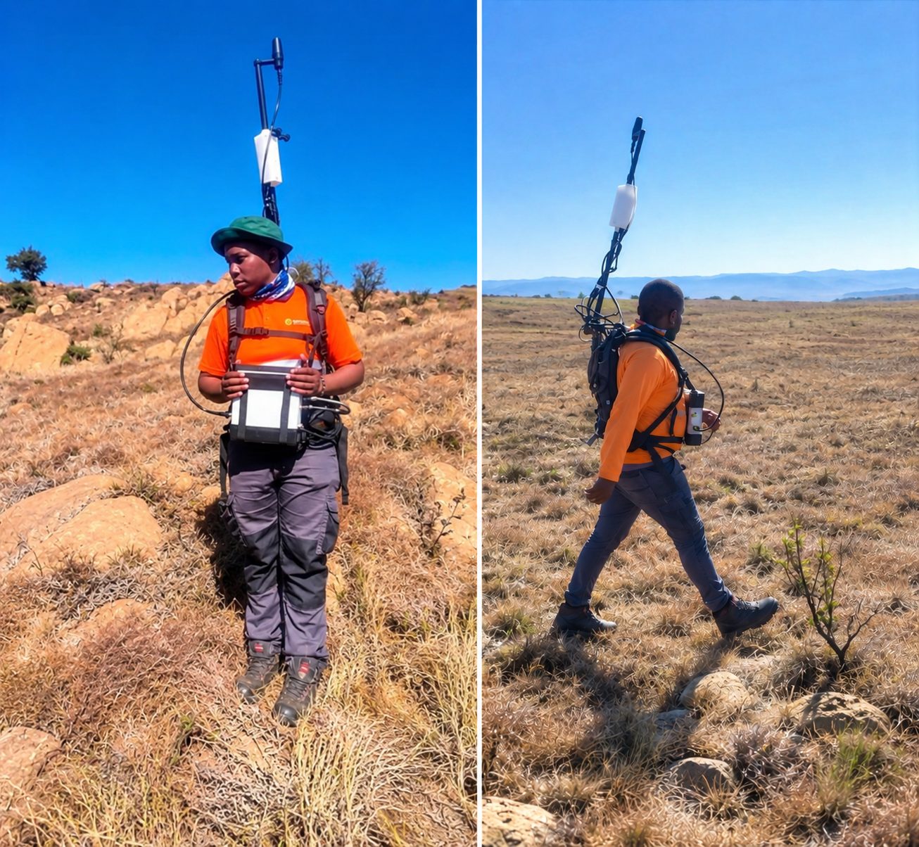
Sekhukhune, Limpopo · August 2026
Ground magnetic survey for chrome exploration at Hoepakrantz
A ground magnetic survey to characterise the subsurface geology and delineate potential chrome-bearing horizons, through systematic measurements, data processing and geological interpretation.
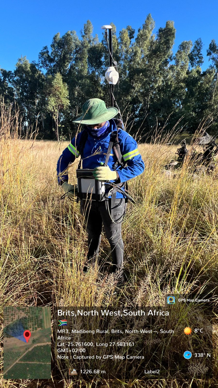
Brits, North West · May 2026
Ground magnetic survey for mineral exploration at Brits
A ground magnetic survey to identify subsurface geological structures, detect magnetic anomalies and delineate potentially mineralised zones.
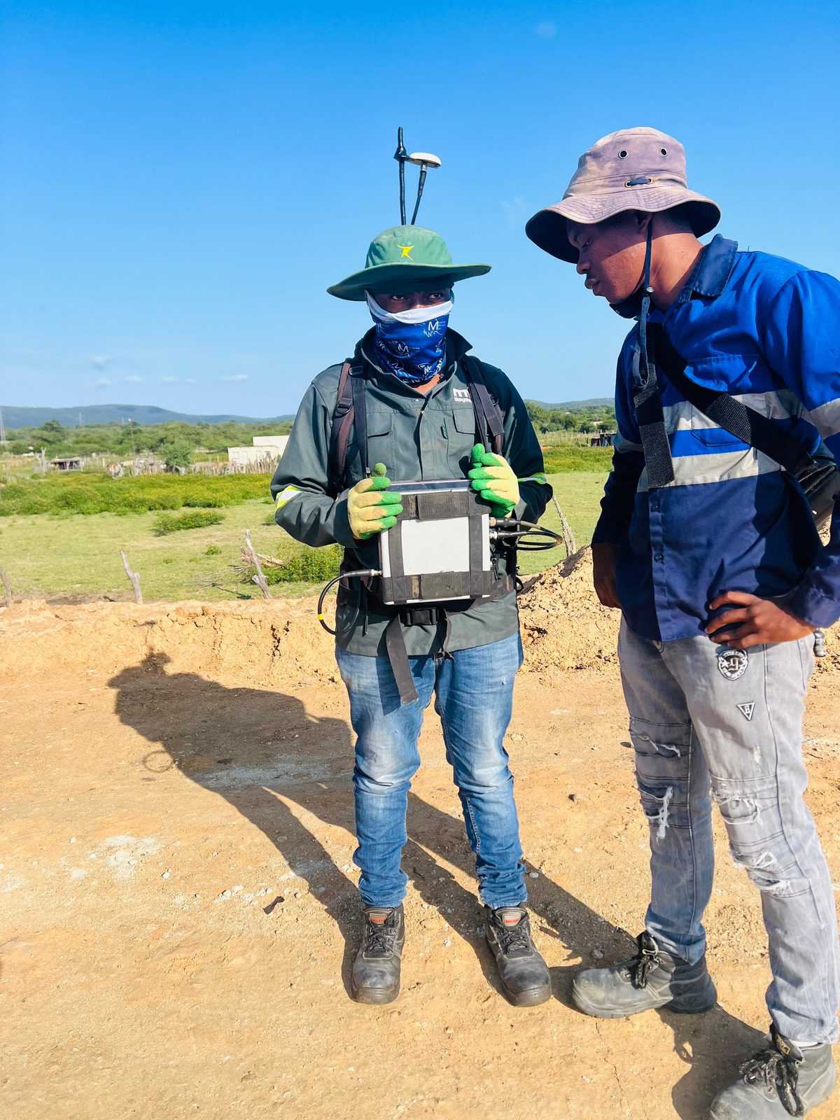
Eswatini · April 2026
Ground magnetic survey for geological structure mapping in Eswatini
A ground magnetic survey to map and characterise subsurface structures, acquiring and interpreting magnetic data to identify faults, lithological boundaries, discontinuities and anomalies.
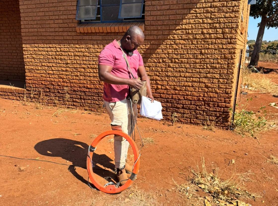
Green Farm, Malamulele, Limpopo · June 2025
Geophysical survey for a new borehole at Tsundzukani Primary School
A desktop study and ground magnetic and electromagnetic surveys to find geological structures with groundwater potential for siting a new borehole.
Questions
Geophysical surveys in Mooi River: questions
Do you offer geophysical surveys in Mooi River?
- Yes. Geophysical surveys for sites in and around Mooi River, run by our team from Midrand. Crysbol Consulting offers professional geotechnical, geological, geophysical and drilling services in Mooi River and surrounding areas. Our experienced teams provide efficient site investigations, technical expertise and reliable project delivery tailored to local project requirements.
How do I get a quote for geophysics work in Mooi River?
- Send us the site location and a short description of the work through our quote form, or call 010 102 3591. We usually reply with a scope and a quote within two working days.
Can a geophysical survey find sinkholes or cavities?
- Gravity surveys can delineate density contrasts that may be associated with weathered zones, low-density material or possible voids. No single anomaly confirms a cavity or shows that a site is safe, so we integrate the results with geology and confirmatory drilling.
Which geophysical method do I need?
- It depends on the geological question, target depth, resolution and site access. Gravity suits dolomite and bedrock variation, magnetics maps dykes and contacts, ERT and EM map conductivity and weathering, and IP targets disseminated sulphides.
Nearby
Geophysical surveys near Mooi River
Geophysical surveys in KwaZulu-NatalAll services in Mooi River
Also in Mooi River
- Geotechnical & dolomite investigations in Mooi River
- Borehole yield testing in Mooi River
- Core drilling in Mooi River
- Geohydrological studies in Mooi River
- Mineral exploration & mining geology in Mooi River
- Mining & prospecting right applications in Mooi River
- Land & engineering surveying in Mooi River
- Water purification & backup water in Mooi River
Need geophysics in Mooi River?
Send us the site location and what you need. We plan field work to cover several sites per trip and usually reply with a scope and quote within two working days.