
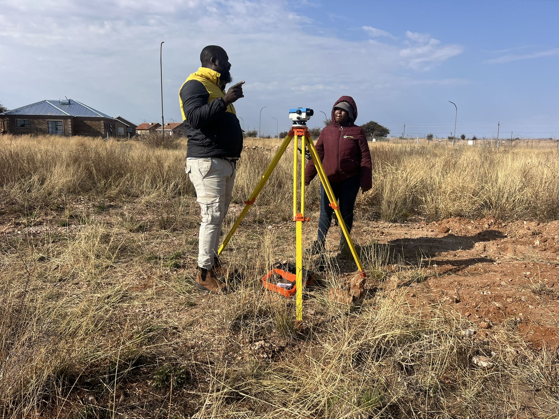
Limpopo · Ba-Phalaborwa Local Municipality
Land & engineering surveying in Gravelotte
Land & engineering surveying for sites in and around Gravelotte, run by our team from Midrand.
Working in Gravelotte
Surveying for sites in and around Gravelotte
Crysbol Consulting offers professional geotechnical, geological, geophysical and drilling services in Gravelotte and surrounding areas. Our experienced teams provide efficient site investigations, technical expertise and reliable project delivery tailored to local project requirements.
Gravelotte is a small mining settlement on the R71 between Tzaneen and Phalaborwa, in the Ba-Phalaborwa municipality. It sits on the Murchison Greenstone Belt, where antimony, gold and emeralds have been mined, and the old gold mining village of Leydsdorp is close by.
From Gravelotte we also cover Leydsdorp and Ofcolaco.
Ground conditions in Gravelotte
The Antimony Line
Antimony and gold are concentrated along a line of quartz-carbonate ridges and shear zones in the centre of the belt. The mineralisation is structurally controlled, so mapping and oriented core are central to exploration.
Metals in mine residues
Deposits in the belt carry antimony and arsenic as well as gold. Tailings and waste rock need to be characterised before rehabilitation, reprocessing or a change in land use.
When you need it
When you need surveying in Gravelotte
- Your design team needs a topographical survey of existing ground and features
- Approved drawings need to be set out on site for foundations, platforms or roads
- Excavation depths, formation levels or foundation positions need checking
- Earthworks or stockpile quantities need to be measured
- Completed works need an as-built survey for handover
How it works
Our process, step by step
- 01
Scope
Survey services, coordinate system, accuracy requirements and deliverable formats are agreed before mobilisation.
- 02
Control
We establish or verify survey control points and benchmarks, and check them against the supplied design information.
- 03
Field survey
Topographical survey, setting out, level checks or volume measurements, as scheduled.
- 04
Calculations and checks
Volumes are calculated against agreed reference surfaces, with survey limits and assumptions documented.
- 05
Deliverables
Survey plans, coordinate schedules, setting-out records, level checks and as-built drawings in agreed PDF and CAD formats.
Recent projects
Land & engineering surveying: recent work
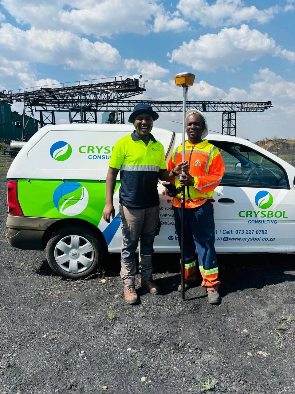
Delmas Coal Mine, Mpumalanga · Quotation accepted October 2026
Surveying for a DMS plant relocation at Delmas Coal Mine
Survey control verification, earthworks setting-out, level monitoring, volume surveys, foundation checks and final as-built surveys for the relocation of a 150 TPH DMS plant.
Questions
Land & engineering surveying in Gravelotte: questions
Do you offer land & engineering surveying in Gravelotte?
- Yes. Land & engineering surveying for sites in and around Gravelotte, run by our team from Midrand. Crysbol Consulting offers professional geotechnical, geological, geophysical and drilling services in Gravelotte and surrounding areas. Our experienced teams provide efficient site investigations, technical expertise and reliable project delivery tailored to local project requirements.
How do I get a quote for surveying work in Gravelotte?
- Send us the site location and a short description of the work through our quote form, or call 010 102 3591. We usually reply with a scope and a quote within two working days.
What is the difference between a topographical survey and setting out?
- A topographical survey records the existing ground and features so that a project can be designed. Setting out does the reverse: it transfers positions and levels from the approved design onto the site so that construction can begin.
Do you do boundary or cadastral surveys?
- Our surveys support engineering and construction. For legal property boundaries, subdivisions or cadastral submissions, tell us when you enquire so the appropriate professional scope can be confirmed separately.
Nearby
Land & engineering surveying near Gravelotte
Land & engineering surveying in LimpopoAll services in Gravelotte
Also in Gravelotte
- Geotechnical & dolomite investigations in Gravelotte
- Borehole yield testing in Gravelotte
- Core drilling in Gravelotte
- Geophysical surveys in Gravelotte
- Geohydrological studies in Gravelotte
- Mineral exploration & mining geology in Gravelotte
- Mining & prospecting right applications in Gravelotte
- Water purification & backup water in Gravelotte
Need surveying in Gravelotte?
Send us the site location and what you need. We plan field work to cover several sites per trip and usually reply with a scope and quote within two working days.